

| | | | ||
| | | |||
| | | | | |
| | | |||
| | | |||
| Drawn by Dr. Douglas Macfarlan in 1937. (original height 21" x width 28 1/2" in color) | ||||
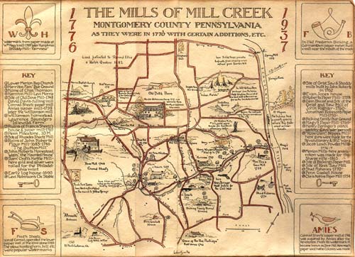 | This creek was a hive of industry in the early days. Flour was ground, logs were sawed, paper was made, and gun powder was manufactured. Later many of the mills became cotton factories. Early in the last century [note: 1800s] steam began to supplant water-power for the mills. - From the lecture notes of Douglas Macfarlan high-resolution image of the map (608K) | |||