
From Actual Surveys & Official Records. Compiled & Published by G.M. Hopkins & Co., 320 Walnut Street, Philadelphia, Pennsylvania. 1871
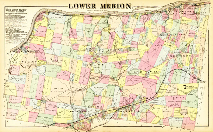
A PDF file is available of the map in high resolution. It is a large (300-500 KB) file, and may take a long time to download, depending on the speed of your Internet connection. You will needAdobe Acrobat Reader to view the file.
Remember to use the ZOOM feature to see map details.
Download the map in PDF format.
Download Acrobat Reader software 
In cooperation with The Lower Merion Historical Society, replicas of this map are available for purchase from:
Franklin Maps
333 S. Henderson Road
King of Prussia, PA 19406
Hours: Mon-Fri 8:30-5 Sat. 11-5
See Ordering Information for details about the reproductions and prices.
tel: 610-265-6277
email: andysantiquemaps@aol.com