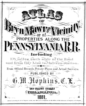
From Official Records, Private Plans and Actual Surveys. Published by G.M. Hopkins C.E., 320 Walnut Street, Philadelphia, Pennsylvania. 1881
List of Plates
Ardmore and Haverford R.R. Stations (Plate 5)
Ardmore South (Plate 4)
Berwyn R.R. Station (Plate 23)
Berwyn R.R. Station detail (Plate 24)(Plate
Bryn Mawr (Plate 12)
Bryn Mawr College and Gladwyne (Plate 8)
Bryn Mawr R.R. Station detail (Plate 11)
Bryn Mawr West (Plate 13)
Cobbs Creek (Plate 3)
Devon R.R. Station (Plate 25)
Gulf Creek (Plate 18)
Haverford, Bryn Mawr R.R. Stations (Plate 9)
Haverford College (Plate 10)
Malvern R.R. Station detail (Plate 27)
Mill Creek area (Plate 7)
Narberth R.R Station, Cynwyd and Belmont Hills (Plate 6)
Overbrook, Merion R.R. Stations and Bala (Plate 1)
Paoli and Malvern R.R. Stations (Plate 26)
Radnor (Plate 19)
Radnor R.R. Station (Plate 16)
Rosemont R.R. Station (Plate 15)
St. Charles Seminary (Plate 2)
Sugartown Rd. (Plate 21)
Upper Gulph Rd. (Plate 17)
Villanova R.R. Station (Plate 14)
Wayne North (Plate 22)
Wayne R.R. Station (Plate 20)