

| | | | ||
| | | |||
| | | | | |
| | | |||
| | | |||
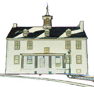
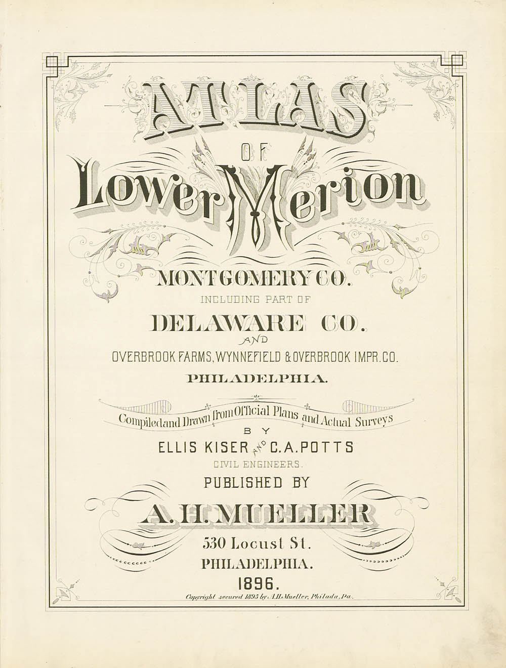
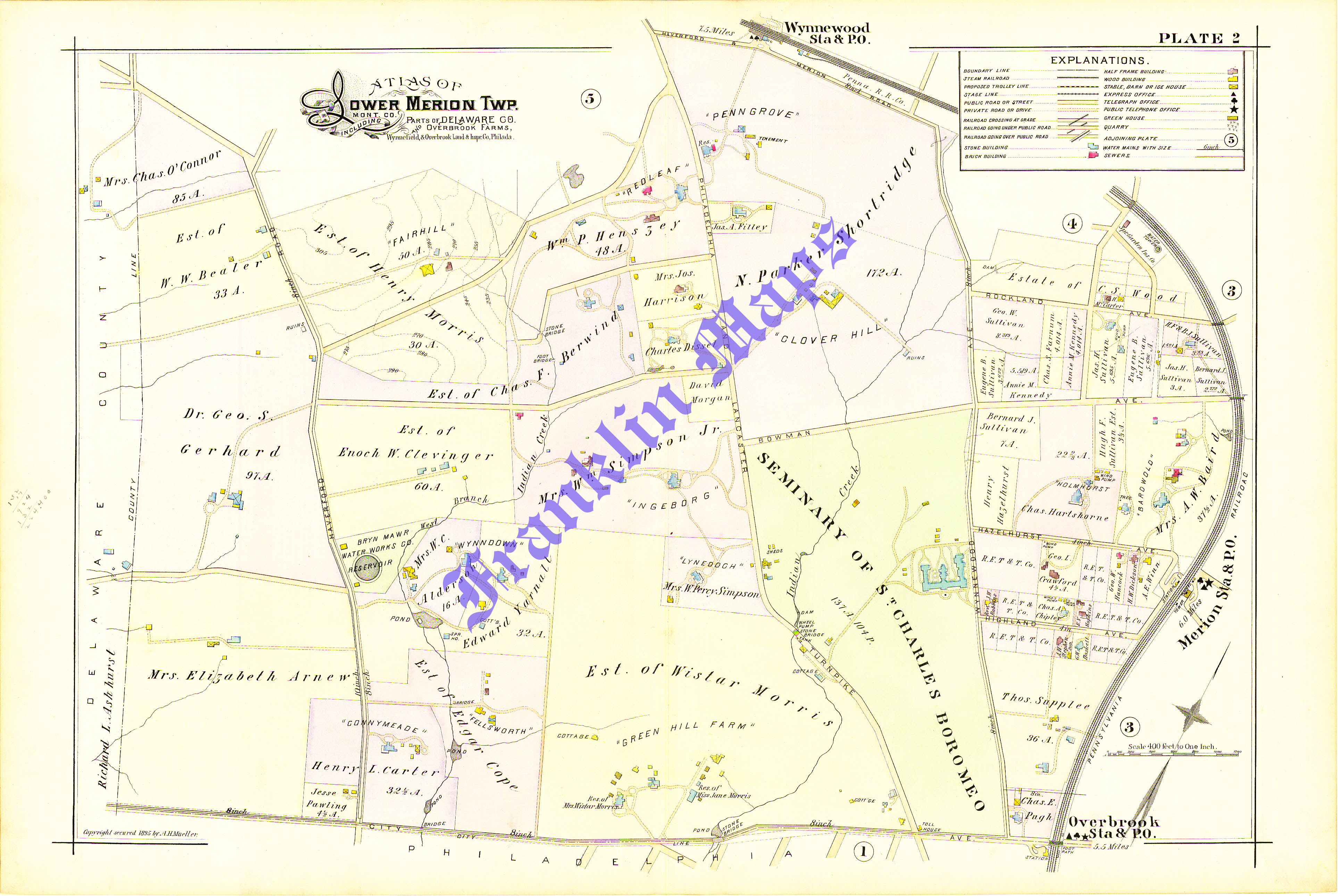
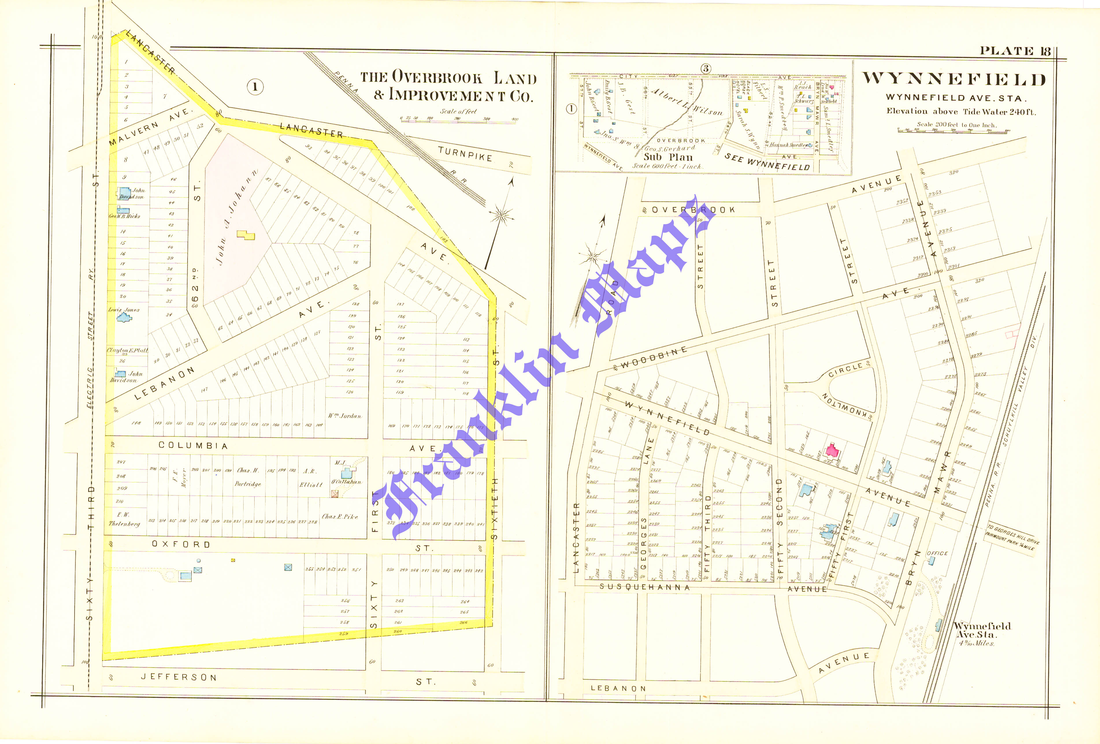
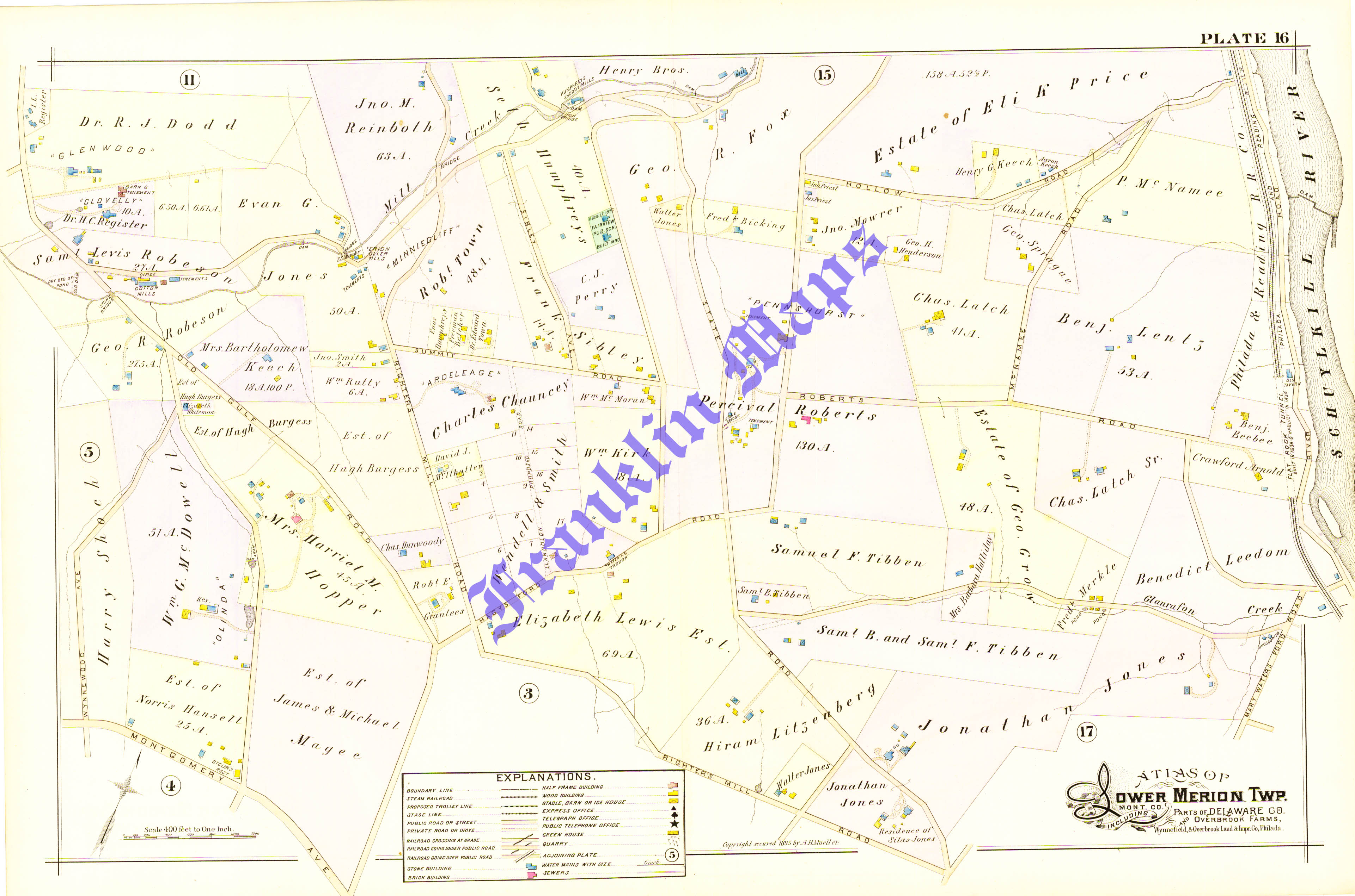
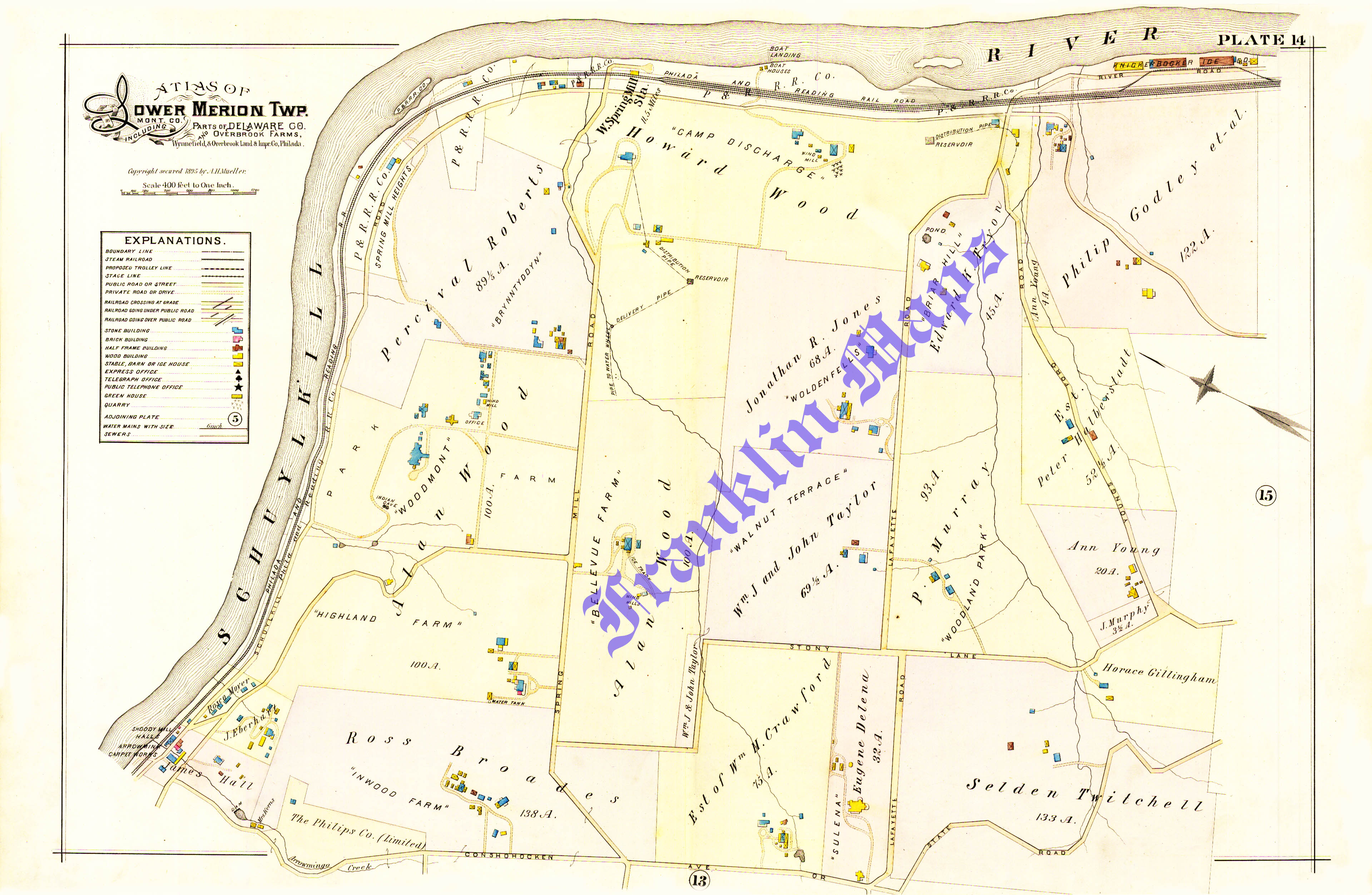
 | Compiled and Drawn from Official Plans and Actual Surveys by Ellis Kiser and C.A. Potts, Civil Engineers. Published by A.H. Mueller, 530 Locust Street, Philadelphia, Pennsylvania. 1896 List of Plates Index Ardmore and Haverford R.R. Stations (Plate 6) Bala and Belmont Hills (Plate 17) Bryn Mawr (Plate 7) Bryn Mawr and Rosemont R.R. Stations (Plate 10) Bryn Mawr College (Plate 11) Gladwyne (Plate 15) Haverford College (Plate 8) Merion, Bala and Cynwyd R.R. Stations (Plate 3) Narberth R.R. Station (Plate 4) Overbrook Farms (Plate 1) Overbrook R.R. Station (Plate 2) Overbrook and Wynnefield (Plate 18) Penn Valley (Plate 16) Rosemont (Plate 12) Spring Mill Road & Conshohocken State Rd. (Plate 14) Spring Mill Road & Montgomery Ave. (Plate 13) Villanova R.R. Station (Plate 9) Wynnewood and Ardmore R.R. Stations (Plate 5) |