

| | | | ||
| | | |||
| | | | | |
| | | |||
| | | |||
| Sold by John Thorton at the Signe of England, Scotland and Ireland in the Minories, and by John Seller at His Shop in Popeshead Alley in Cornhill, London. First Map of Pennsylvania Under William Penn, 1691. (copy height 18" x width 22" black and white)
| ||||
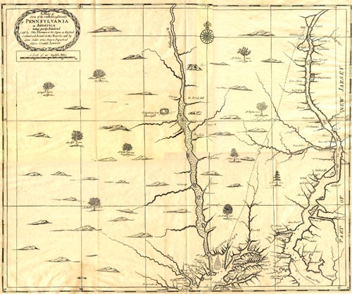 | Just north of the "Skoolekil" River is the "Wicoco" Plantation which was the future site of Philadelphia. William Penn selected this site because "It seemed appointed for a town, because of its coves, docks, springs, and lofty land!" [from John F. Watson. Annals of Philadelphia and Pennsylvania in the Olden Times. Philadelphia: Whiting & Thomas, 1856. Vol. 1. p. 55]
| |||